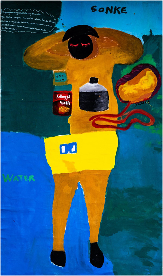
Thanda knelt before a life-sized canvas where her body was traced and painted, floating amidst greens and blues, an umbilical cord linking her to her son. Created by her own hand, this body map narrates her survival story (Jager et al., 2016). This photo essay captures the stories of individuals from the Quarry Road West informal settlement who participated in a series of different arts-based research (ABR) workshops, designed to help survivors of the 2022 Durban floods express their experiences through visual storytelling (Ragus et al., 2024). ABR methodologies align with the principles of the “Disaster Studies Manifesto” by acknowledging and working to reduce the power imbalances inherent in research and by creating space for local perspectives and experiences of disasters to be meaningfully represented. This was important, as the first two authors are both white and non-South African and were conscious of their positionality in relation to South Africa’s past. The second two authors are local researchers who live in the impacted community. Taking place one year after the disaster, these workshops provided a platform for community members to reflect not only on the immediate trauma but also on the broader disruptions to water-energy-food (WEF) systems that shaped their recovery.
The 2022 floods were catastrophic: the South African government declared a national state of emergency (Udo and Naidu, 2022) and deployed 10,000 troops for rescue and relief efforts (Magome, 2022). Nearly 500 lives were lost, many remain missing and over 130,000 people were displaced – exposing both the devastating force of the floods and the deep structural inequalities embedded within Durban’s urban planning and emergency response systems (Bond and Galvin, 2023; Mudefi, 2023). Although destruction cut across class lines, bringing down million-dollar mansions and informal homes alike, the aftermath revealed a familiar pattern: pre-existing inequalities deepened (Barrios, 2017). Access to clean water, stable energy and food security fractured further, shaping who was able to rebuild – and who was left behind.
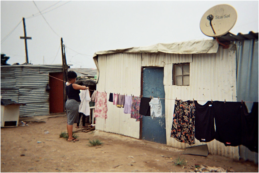
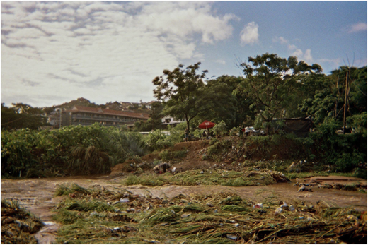
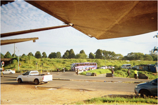
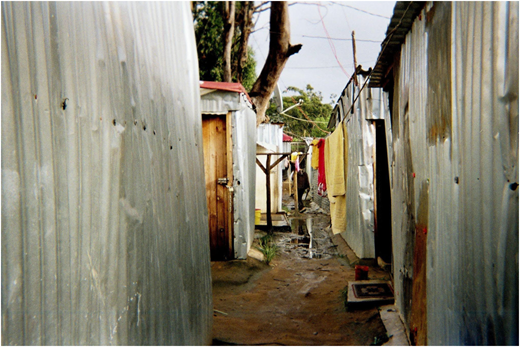
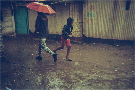
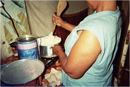
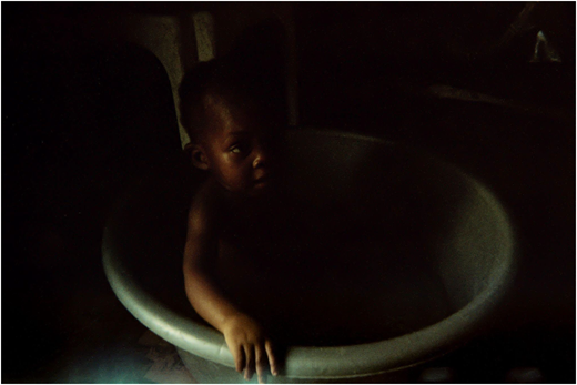
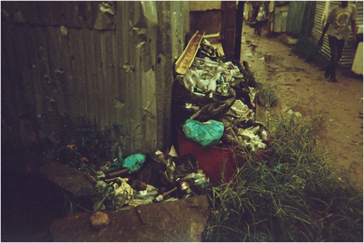
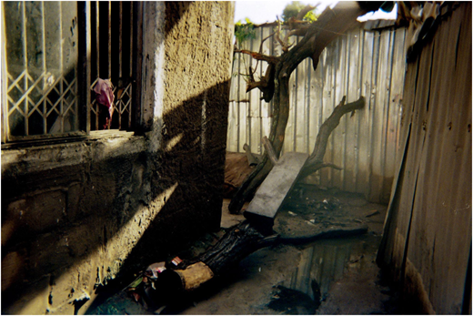
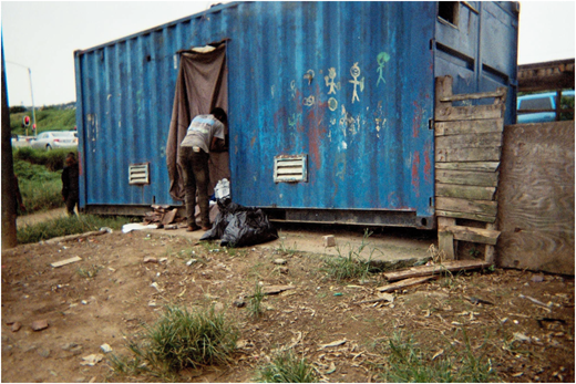
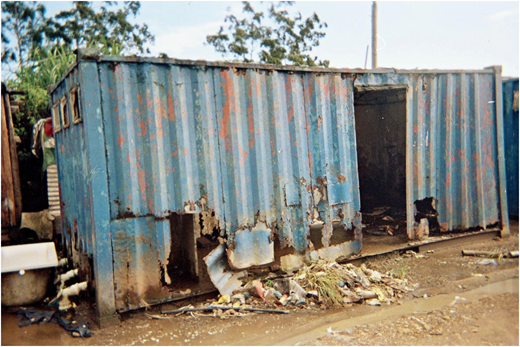
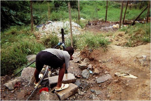
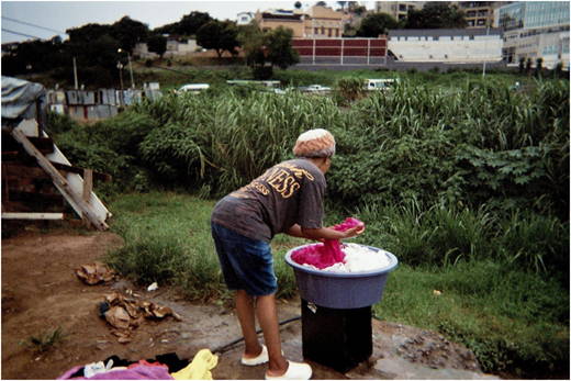
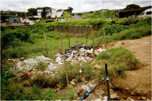
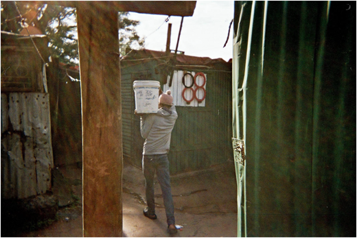
Thanda (whose body map is in Figure 1) lives in Quarry Road West, an informal settlement along the Palmiet River, squeezed between the river and a highway. These informal settlements in South Africa are a direct legacy of apartheid's spatial planning, where Black South Africans were pushed into marginal spaces with few services. Approximately 1,100 families live there, often relying on illegal electricity connections and perpetually struggling to access clean water and sanitation (Mazeka et al., 2019) (see Plates 2–16).
In her body map, Thanda paints her flood story, showing the rising levels of the Palmiet River as floodwaters encroached around her home. In the days leading up to the disaster, persistent light rain had saturated the already unstable terrain along the edges of the river. That day, as she prepared a meal for her son over a paraffin stove (an everyday reflection of the precarious energy systems in this informal settlement), she noticed early signs of trouble. Although the settlement initially seemed calm, with most residents sheltering indoors, she remembers looking across the river into her neighbors, where she saw their informal homes collapsing at the river as the sandbanks eroded under the weight of the water. Thanda recalled panic setting in. “I was cooking for my son, and when the water came, I just needed to find him.” Her pot boiled over as she rushed outside, floodwater already swirling around her ankles. Calling frantically for her son, she stumbled toward the highway, searching for higher ground. Around her, illegal electricity lines snapped and fell, their live wires sparking deadly threats in the rising water. Chaos unfolded as families fled their makeshift homes: some clutching cooking pots, mattresses or schoolbooks – the essentials of daily survival – others abandoning everything in a desperate sprint for safety. In that moment, the intricate entanglement of water, energy and food systems was exposed.
While the number of deaths and the scale of damage that occurred in the aftermath of the 2022 Durban floods tell part of the story, they miss the deeper truth: disasters like the Durban floods are not just the result of a changing climate, but they are the outcome of political decisions, economic inequalities and historical neglect. As climate change intensifies these weather events, the pre-existing injustices will exacerbate their deadly impact. These inequalities are deeply entangled with people’s environments and how they live. Thanda's story illustrates how disasters disrupt the fundamental systems that sustain life – water, energy and food – exposing the vulnerabilities inherent in them. During the floods, clean water sources were contaminated by overflowing sewage and debris; illegal and unsafe electricity lines collapsed into floodwaters, turning escape routes into lethal hazards and food supplies spoiled as homes and markets were destroyed. These breakdowns are not isolated failures; they reflect how interconnected and fragile the WEF systems are, especially for marginalized groups (Daher et al., 2021). While the WEF nexus is often treated in policy circles as a technical coordination problem, disasters make clear that it is also a social and political crisis (Albrecht et al., 2018). In the Quarry Road West informal settlement, weak infrastructure, insecure land tenure and limited access to safe services meant that when one system failed, it dragged the others down with it. The floods exposed how disruption in one part of the nexus rapidly cascades across all aspects of survival. Thanda's painting captures these ruptures not as abstract policy challenges, but as her daily reality, where the failure of the WEF nexus meant the difference between life and death.
About the author
Emily Ragus is a PhD candidate in Anthropology at the University of Amsterdam. Her research focuses on environmental collapse and the processes of repair, drawing on 14 years of experience as an emergency nurse, including helicopter retrieval work and deployments to conflict zones with the International Committee of the Red Cross. Alexandra Rose Howland is an artist and photographer who works in pre- and post-conflict settings, using long-term ethnographic methods to explore complex social and environmental issues. Together, they are part of a research collaborative that examines the intersection of art, science and disaster to better understand how crises shape societies and environments.
Author contribution statement
This photo essay is the result of a collaborative ABR project. Emily Ragus facilitated the workshops and wrote the text in collaboration with all co-authors. Alexandra Howland contributed photographic framing and editing, as well as shaping the visual and thematic focus. Andisiwe and Pinky Sonjica participated as co-researchers, guided the narrative direction and created the photographs. All authors contributed equally to the production of the essay and consent to being listed as co-authors.