1. INTRODUCTION
Owing in part to new-found wealth, newly created economic drivers and increasing globalisation and interaction in the world's economy, many cities of the world, in particular in the Middle East, are undertaking development on a massive scale or undergoing redevelopment initiatives. Cities with hitherto limited urban development, such as Dubai, are being trebled every decade in terms of the size of the urbanised area. Urban design projects that traditionally involved addressing the design of, for example, a grouping of buildings or a city block, will typically now cover large parts of a city or even involve the creation of a new city. Such a new city could be as large as ‘Dubailand’ in Dubai, which covers 300 km2, or 150 times the size of the principality of Monaco, which is little short of the dimensions of a small country.
Three such large-scale design projects, located in Dubai, are presented in the current paper. All three projects were commissioned either by government or by para-governmental companies to the planning department of Halcrow Group Ltd. These examples are presented to illustrate some of the issues driving the planning and design of large projects.
2. ‘DUBAI INTERNET CITY’: A NEW ‘CITY WITHIN A CITY’
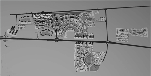
In 2000, HH Sheikh Mohammad Bin Rashid Al Makhtoum, the ruler of Dubai, announced his intention to establish a business park with a common infrastructure base to support internet technology, media-based industries and related research and development institutions. Dubai Internet City, covering only 3 km2, was conceived as the catalyst to launch Dubai as the preferred regional base for the world's leading media and technology companies, and the vehicle to foster a technological shift in government operations (see Fig. 1).
In the urban context, Dubai Internet City serves as a new employment and activity node between downtown Dubai and Jebel Ali, with three core uses
as an internet city providing office space for mature businesses and starter units for incubator industries
as a media city incorporating offices and studios for the media industry
as a knowledge village offering higher level education as well as research and development facilities.
These prime functions are supported by a central business district with premises for technical, administrative and legal service industries, and land for hotel, residential, commercial and leisure activities.
While planned as a predominantly low-rise development, the scheme makes allowances for high-rise buildings in two places. The first is at the circular epicentre of the development, an area that serves as the portal to the Palm Jumeirah development. The second is located along the site's frontage to Sheikh Zayed Road, Dubai's main urban arterial road.
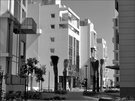
The master plan set out to engender a human scale of development with low-rise buildings, extensive shaded pedestrian networks and courtyards with small-scale water features and indigenous landscape (see Figs 2 and 3). A rigorous set of urban design guidelines was developed to ensure this vision. The guidelines stipulated building height, building form, landscape design and parameters for building materials, colours and roof lines.
Construction on site began (in parallel with the completion of the master plan) in 2001 and 2002. As early as 2001, within a year of the announcement of the project, the site occupants came to include top international names, including Microsoft, IBM, Infosys, Oracle, Sun, Cisco, HP, Nokia and Siemens.
Dubai Internet City became the region's first ‘city within a city’, forming the blueprint for clustering interlinked activities within a single urban site, providing assistance to incubator industries and affording free zone status (including complete foreign ownership) to businesses within the development. This formula has since been followed for other economic activity zones in Dubai such as ‘Silicon Oasis', and the ‘International Media Publishing Zone’.
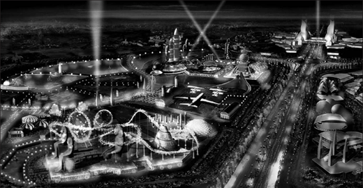
3. ‘DUBAILAND’: A THEME PARK AND RESIDENTIAL MEGA-PROJECT
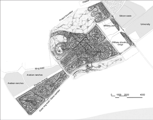
Dubailand is a new urban node and tourism destination, located across an extensive area of over 150 km2 along the recently opened Emirates Road that connects Dubai with its neighbouring Emirates. The project was intended to cater for the increasingly global workforce stationed in Dubai and for the ever-increasing numbers of tourists and visitors coming to the city.
The project involved four steps
the preparation of an initial framework plan (see Fig. 4)
consultations with potential investors and their architects
a plan refinement exercise incorporating the investors' proposals
detailed plans for individual projects, prepared by the investors' own consultants.
The initial framework plan, based on an appraisal of the leisure, tourism and residential markets both regionally and internationally, offered broad locations for the placement of different types of themed developments (see Fig. 5). These included a range of different zones for active recreation such as indoor entertainment, mechanical rides, sports complexes and car racing circuits, as well as more passive and quieter zones catering for water-themed housing, golf-themed properties and desert-experience resorts. The refined framework plan was then modified in terms of plot sizes and detailed land uses to reflect the aspirations of confirmed investors. The refined plan also identified locations for anchor developments that would lend critical mass to the project during its early stages.
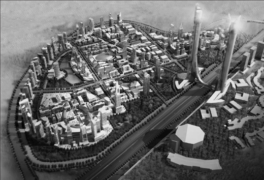
Detailed master plans were prepared for three themed neighbourhoods for the developer Tatweer in 2006. Originally named ‘The City’, ‘Athenopolis’ and ‘Frisco Ridge’, the sites were later known as ‘Majan’, ‘Arjan’ and ‘Liwan’ respectively. Majan is a mixed-use development on 180 ha designed to echo the vibrant streets and the pace of downtown Manhattan (see Fig. 6). The plan for Arjan on 240 ha draws on references from the ancient sporting and performance arenas of Greece and Rome and combines these references with the iconic architecture and urban planning principles of these ancient civilisations. The Liwan plan on 120 ha capitalises on the existence of a naturally occurring ridge and draws references from the urban structure of San Francisco with a commercial downtown and a residential area set within a hilly landscape.
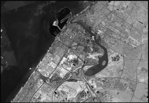
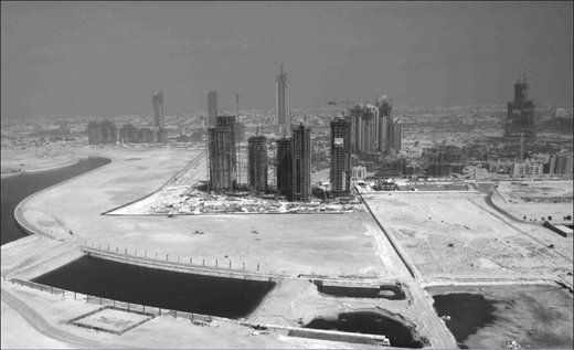
4. ‘BUSINESS BAY’: A NEW CENTRAL BUSINESS DISTRICT FOR DUBAI
The creation of a new central business district (CBD) for Dubai was conceived by the leaders in Dubai as a means to sustain the city's position as one of the world's leading trade locations and the region's premier business and tourism centre (see Fig. 7). The new CBD, called ‘Business Bay’, also addressed a number of specific urban issues.
Dubai is expanding rapidly. Its population of 1·3 million is expected to double by 2015, and to rise to around 4 million by 2020.
The old CBD is now inefficient. The old city centre was built in the 1970s and 1980s along both banks of Dubai
Creek, a tidal inlet stretching some 11 km inland. The area is congested, its urban fabric is no longer able to cater for modern business needs and many of its buildings are in decay.
Waterfront land is scarce. Water is a prime landscape asset in an environment where hills and natural vegetation are rare. Most of Dubai's natural coastline has been taken over by residential and port development.
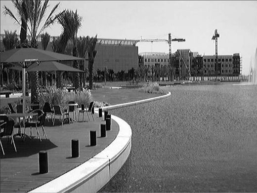
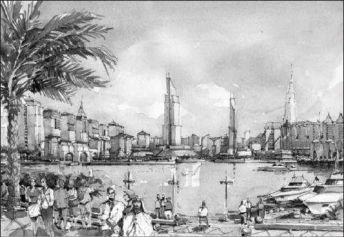
Business Bay is sited near the old city centre to serve as an extension of the existing CBD. The core of the project is a new waterway that extends Dubai Creek by a further 11 km in a ‘U’ shape, which links the existing creek back to the open sea. Land along this new waterway will serve as the setting for a new CBD.
The new canal passes through a series of sparsely developed city blocks, providing high-amenity waterfront plots for new commercial development and added value to landlocked city blocks. Some 30 km2 of new sites will be created for businesses, housing and institutional facilities, with an expected population of around 250 000 residents and 135 000 workers.
The waterway's outlet to the sea passes as a narrow canal between Safa Park and existing villas. South of this outlet, the waterway crosses a city block of some 2 km2, where it widens to form a central bay (see Fig. 8). The bulk of the new CBD's tall offices, mixed-use buildings and residential apartments will be located here. East of this central bay, the waterway narrows once more and low-density business parks and housing are planned along this stretch. An existing birdlife habitat covering some 600 ha of mangroves and tidal flats is located at the confluence of the new waterway and Dubai Creek. This city landmark will be conserved as a wildlife sanctuary.
The project is under construction and the new waterway (being created through dry excavation, see Fig. 9) is now complete, although the western link to the open sea has not yet been breached. Roads are being built and all land within the central bay of the new CBD has already been sold.