

The British Dam Society conference was held in Leeds in 2012. As part of this successful conference, the attendees had pre-selected which one of four tour groups they would like to participate on. This short paper describes the visits made on conference tour A to Baitings, Boothwood and Scammonden reservoirs, detailing the scale and specifics of each dam structure.
The weather was relatively kind to the participants of the British Dam Society conference tour A, who made very interesting and informative field trips to Baitings, Boothwood and Scammonden reservoirs, west of our host city of Leeds and all operated by Yorkshire Water.
The first stop on the tour was Baitings reservoir, lying in the valley of the River Ryburn, close to Ripponden in the West Yorkshire Pennines. Constructed in 1956 in accordance with the Reservoirs (Safety Provisions) Act 1930 (1930), the dam is a mass concrete gravity structure 51 m high and 470 m long, constructed as a series of discrete monolithic blocks, separated from each other by movement joints (Figure 1).
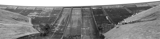
The reservoir has a capacity of 3523 Ml and catchment area of 7·16 km2, which drains to the reservoir basin by way of the River Ryburn and side streams known as Horse Hey Clough and Clay Clough. The areas that drain to the reservoir comprise rough open moorland that is typical of the foothills of the Pennine Moors.
A short drive back through Ripponden brought us to the Turnpike Inn for lunch and in time to watch heavy rain showers over Boothwood reservoir, the next stop on our tour.
Boothwood reservoir was completed in 1971, also in accordance with the Reservoirs (Safety Provisions) Act of 1930. The dam was constructed as a series of discrete monolithic blocks, separated from each other by movement joints, and is 48·3 m high and 350 m long (Figure 2).
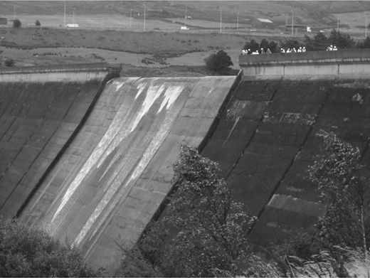
The reservoir has a capacity of 3636 Ml and catchment area of 18·86 km2 and has its own catchwater channel that runs around the south side of the basin, known as the Moss Moor catchwater. Excess discharge in this channel would overflow to the reservoir at a number of locations along the southern flank.
A short drive from here brought us to our final visit of the day, Scammonden reservoir. Scammonden dam is a 76 m high rock fill embankment, 625 m long, filled with an extensive array of instrumentation equipment. The embankment is considerably larger than needed, as it also carries the M62 along its crest – the only such structure in Britain (Figure 3).
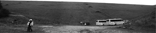
The overflow system comprises a Bellmouth overflow weir leading to a drop shaft located in the right abutment of the dam. A vertical steel lined transition curve is located at the base of the shaft and leads to a horseshoe shaped overflow tunnel, leading to a tailbay with a crump weir passing into a stilling pond located at the downstream toe.
The reservoir has a capacity of 7873 Ml, a direct catchment area of 5·24 km2 and indirect catchment area of 17·69 km2. The motorway, which was dependent on the completion of the dam, was opened to traffic on 20 December 1970 and officially opened by HM Queen Elizabeth II, who unveiled a plaque near the valve tower of Scammonden reservoir on 14 October 1971.
Thanks go to Andrew Hobson of Yorkshire Water for the organisation of the tour and the Yorkshire Water Operatives who showed us round and answered our challenging questions.

