On19 October 2011 a party of BDS members visited the site of the Abberton dam, just south of Colchester in Essex which is being raised as part of the Abberton Reservoir expansion project. The project increases the yield of the reservoir by 50% and includes pumping stations and pipelines off the site, which are substantially complete and were not visited.
The visit was hosted by the owner, Essex and Suffolk Water, and MWH. Carillion, the main contractor for the works on the dam, provided safe access to the site and transport around the reservoir. There is a full perimeter road 11 miles in length.
The dam was completed in 1939 on the course of the Layer Brook, holding 26 000 Ml at a top water level of 17·8 m AOD. The natural catchment is very small and it is filled by pumping from the River Stour. This is supported by the Ely-Ouse to Essex Transfer Scheme, over a distance of 141 km.
The visit started with a short video and a description of the history of the dam including references to a major slip during construction and the continued presence in the reservoir of mines from the Second World War. Partly because of access restrictions for recreation the reservoir is now of major importance for wildlife, being a Ramsar site (UNESCO, 1994) and special protection area (SPA). This significantly affected the promotion and design of the raising scheme.
The zoned embankment had a puddle-clay core, selected clay fill near the core and gravel shoulders. All material was sourced on site.
The top water level is being raised by 3 m, except for the middle and upper sections of the reservoir which are being retained at the original level. This meant that a road causeway forming the B1026 had to be converted to a water-retaining structure and a pumping station built to transfer the natural inflow into the main section (Figure 1).
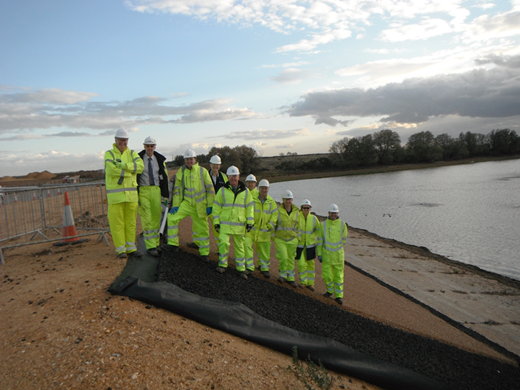
BDS members standing on the raised causeway
BDS members standing on the raised causeway
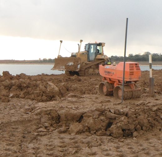
The original puddle clay was exposed and visible on the day of the visit. Rolled clay was compacted on top with placing of the 300 mm thick layers controlled by global positioning system (GPS)-guided machines (Figure 2).
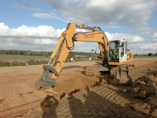
Gravels were washed, graded and partially crushed to make filter material. Coarse and fine filters were placed between the new rolled-clay core and the shoulders after compaction using an ingenious box device (Figure 3).
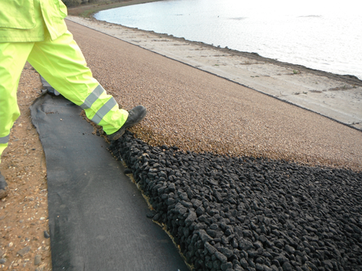
The upstream slope of the dam was originally protected using concrete blocks. The majority of these had already been removed, crushed and used in the new site roads. The new slope protection was open stone asphalt (OSA) by Hesselberg Hydro, typically 300 mm thick, with a crushed stone aggregate. On the causeway the OSA was overlain with a gravel bound by a clear polymer for visual reasons (Figure 4) – it looked like peanut brittle!
The overflow swallow hole had major reconstruction to raise the structure. At the base of the shaft the existing needle valve had been replaced with a cone valve to increase the draw-down capability (Figure 5). This was the topic of a paper by Rhiannon Morris presented in the final of the BDS Prize competition.
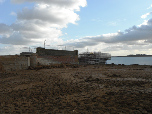
Work was in progress compacting fill around the swallow hole with the intention of completing the raising of the embankments to full height by December 2011.
Raising the top water level also required the construction of 4 col dams, to stop the water escaping into the catchment to the south. The wildlife visitor centre had been rebuilt on higher ground and the B1026 was being diverted.
The draw-off works had major reconstruction and were on the critical path as supply to the treatment works had to be maintained at all times. It was not possible to see this part of the site and it hoped that another visit can be arranged. Completion is due in 2012.
Thanks were expressed to all the staff from MWH, Essex and Suffolk Water and Carillion who made this very interesting visit possible.